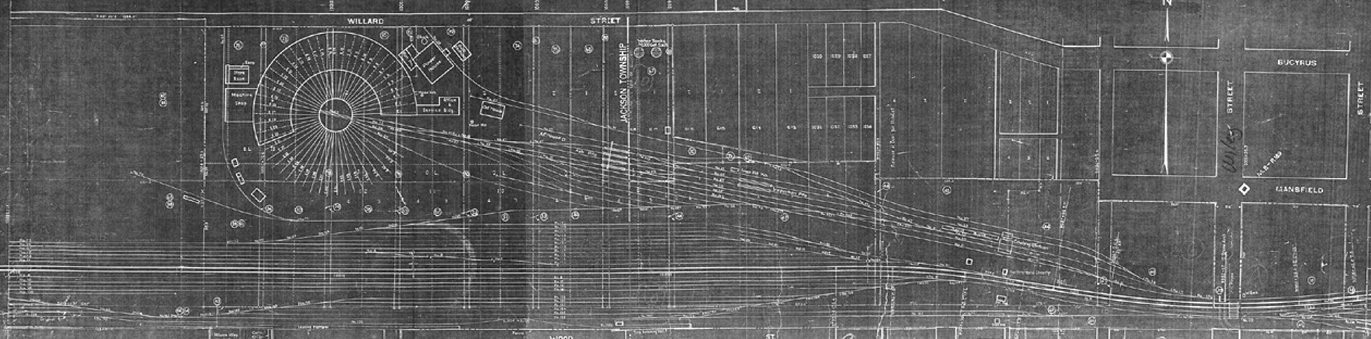
This is a portion of a PRR map for the Crestline Engine Facilities, correct as of Dec. 31, 1942. It shows the complete engine servicing area, with the westward recieving yard to the south of the roundhouse and the eastward classification yard below , with the main line running between the two yards. The title block says "RIGHT OF WAY AND TRACK MAP, PITTSBURGH, FORT WAYNE & CHICAGO RAILWAY, Office of the PENNSYLVANIA COMPANY, EASTEN DIVISION, Station 9967+35 to Station 10020+15". The earliest date that appears on the map is June 30, 1917. The map has been modified numerous time through the years as changes have been made to the area.
As the locomotives came in from the main line, their first stop was at the coal dock, sanding facility, inspection pits, and then the ash pits. If the engines required servicing, they then proceeded to the roundhouse. If there was no room for them in the roundhouse, they were parked on the circle tracks to wait their turn. After the engines recieved a clean bill of health, they were sent to the ready tracks, where their fires were tended and they awaited dispatching.
The undated aeriel view of the facilities in the early 1940s is very much as this map depicts. One major difference, though, is the approach and service tracks on the west side of the roundhouse. At the bottom of the photo, it shows what looks like some grading being done to construct a "wye" track, most likely in anticipation of the arrival of the S-1. Since the S-1 was approximately 146' long, it required turning on a "wye". It's also possible that the "grading" is the remains of the original "wye" track, and the curve was being broadened to accomodate the extreme length of the S-1.
Go to: Home | Photo Gallery | History | Duplex and Experimental Steam Engines | Burkhart Photos | PRR Roundhouse Drawings | Preservation